- When: December 2, 2025
- Time: 5:00 p.m. – 7:30 p.m.
- Location: Holy Trinity Evangelical Lutheran Church at 516 Victoria Ave, Belleville
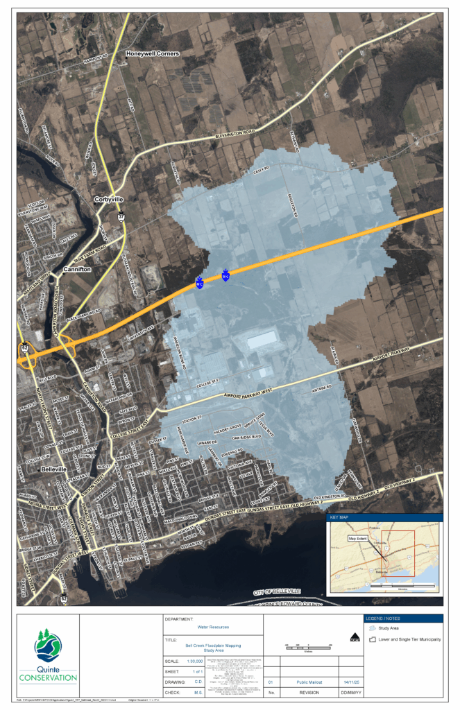
Quinte Conservation is holding a public information centre on Dec. 2 regarding updated floodplain mapping for areas along Bell Creek. This floodplain covers a large portion of the eastern half of the city. The study aims to manage flood risk and ensure sustainable development practices for the region.
The information session will be held on Dec. 2 from 5 to 7:30 p.m. at the Holy Trinity Evangelical Lutheran Church (516 Victoria Ave.).
Learn about the study, speak with Quinte Conservation staff & project consultants, and have your say.
Natural hazard maps are important tools used by municipal governments, Conservation Authorities, and planning agencies to guide development, zoning, and emergency preparedness. These maps are used when reviewing development applications to assess natural hazards such as flooding, erosion, and steep slopes, which can pose risks to both people and property. For properties within the floodplain or associated setbacks, development requires approval from Conservation Authorities before building permits are granted.
The last floodplain mapping for Bell Creek was developed in 1984 and is being updated to reflect changes in land use and climate data. Using advanced floodplain mapping tools such as topography, bathymetry, water resource modeling, and field surveys, the study aims to accurately delineate flood-prone areas and provide a clearer understanding of flooding hazards during various storm events. This mapping will help to better inform future development decisions, land use planning, and flood mitigation strategies in the region.


Comments
We want to hear from you! Share your opinions below and remember to keep it respectful. Please read our Community Guidelines before participating.