The Policy Directions Report serves as a strategic roadmap for updating the City of Belleville’s Official Plan. Rather than creating an entirely new plan, this review recommends targeted updates to align with Provincial legislation and policies including the Planning Act, Provincial Planning Statement (2024), the city’s Housing Accelerator Fund (HAF) commitments, and updated growth forecasts extending to 2051.
Summary
- Planning window has been extended from 2038 to 2051 to align with updated growth projections identified in the Population, Housing, & Employment Growth Forecast, prepared in December 2022 by Watson and Associates.
- Belleville’s population is now projected to reach approximately 75,200 by 2051 (a growth rate of 1% per year), a significant increase from previous estimates of 58,300.
- Housing preferences by unit type are anticipated to gradually shift towards medium- and high-density housing forms over the long term.
- Growth will be accommodated through efficient use of existing serviced land, the logical extension or improvement of services, and appropriate infilling.
- Minimum residential density target is proposed to rise from 14 units to 40 units per gross hectare.
- City aiming for 10,540 new units through intensification and redevelopment by 2051, averaging 350 units annually.
- Over the 2021 to 2051 forecast period, new housing is forecast to comprise 45% low-density (singles and semi-detached), 23% medium-density (townhouses), 23% high-density (apartments), and 9% secondary units.
- In line with the PPS (2024), “municipal comprehensive reviews” are no longer required for settlement area boundary expansions, allowing these requests to be considered more frequently, provided they meet strict provincial criteria.
Residential/housing
The Municipality will support forms of gentle intensification, which generally refers to new housing within existing residential neighbourhoods, including infill, where additional housing units are provided of slightly higher density than the surrounding density, in a way that is compatible with the existing neighbourhood. To support gentle intensification efforts, the City will provide policy guidance to permit multiple units as-of-right, on urban serviced lots where a detached dwelling, semi-detached dwelling or freehold townhouse dwelling is permitted, where appropriate, and subject to any criteria including servicing capacity. In addition, the City will support the development of “missing middle” housing forms (meaning multiple unit housing including, but not limited to multi-unit two-unit, three-unit, stacked townhouses, apartments, and other low-rise housing options).
As part of the HAF initiatives, the City has committed to permitting four units as-of-right on urban, serviced lots where certain residential typologies
are permitted. The City may explore additional units as-of-right in certain contexts as part of its commitment to meeting housing needs.
Rental
To maintain housing diversity, the report introduces stricter controls on the loss of rental stock.
- Condo conversion limits: The city will generally not support converting rental housing to condominiums unless the rental vacancy rate has been at or above 3% for two consecutive years.
- Tenant support: Applicants for conversion must provide relocation assistance for three years and moving costs to affected tenants.
Increase residential density limits
3.10.2 a) Residential development within areas designated Residential Land Use should be permitted to occur at various densities within the City to ensure a full range of housing forms at different sizes, tenures, and styles including market-based and affordable housing that meets the needs of all citizens is provided. Densities are provided as “net residential density,” which means the total number of residential dwelling units per hectare of land excluding all roads, stormwater management facilities, utility corridors and similar which are necessary to support the residential area. The densities that are supported by this Plan are as follows, subject to servicing capacity:
- Low density residential uses would normally include ground oriented dwellings such as single detached dwellings, and semidetached dwellings, and multiunit dwellings developed up to a maximum of 28
25units per hectare net residential density. Gross density for greenfield residential subdivisions will be up to a maximum of 40 units per gross hectare.- Medium density residential uses would normally include various types of multiple unit dwellings or townhouse dwellings, and small
- low-rise multi-unit complexes, and small-scale mixed use buildings, developed up to a maximum of 75
60units per hectare net residential density. Medium density housing should front onto a local street which leads directly to a collector or arterial street but which does not run through significant areas of sensitive land uses leading to the collector or arterial street (i.e. significant areas of low density residential uses).- High density residential uses would normally include various types of multiple dwellings such as mid-rise and high-rise multiunit complexes and mixed use buildings, developed to a maximum of 115 units per hectare net residential density.
In order to implement the planned densities and housing, the following shall apply:
- i. Lands suitable for medium and/or high density residential, including Specific Policy Areas, shall not be downzoned for lesser density than permitted by the implementing zoning by-law.
- ii. Increases in density beyond the permissions identified in this Plan may be considered. In all such instances, the proposed development shall:
- a. Incorporate affordable housing units with an agreement to maintain the affordability of the units for a minimum of 25 years;
- b. Incorporate contributions to streetscape design elements, public art, active transportation, andenhanced landscaping;
- c. The proposed development may be required to contribute to overall public benefit including, but not limited to, child care, commercial services for residents, publicly accessible parks that are privately owned, and transportation demand management requirements;
- d. Incorporate a higher level of urban design to ensure compatibility with the surrounding area, including use of highquality materials and façade design, and the use of angular planes to minimize overlook and shadowing onto adjacent properties.
Mixture of housing types should be included, but neighbourhood character still considered
The type and arrangement of dwellings and densities are important to the character of the City and specific residential neighbourhoods. All
neighbourhoods should contain a mixture of dwelling types at different densities, including missing middle housing and other forms of gentle
intensification that integrate with the built form character of the neighbourhood.
In implementing a mixture of dwelling types for neighbourhoods, Council shall should consider the following:
- the capacity of servicing systems to adequately handle the traffic, water and sewage flows, and other services to and from the area once fully developed;
- the ability of the proposed development to integrate with the existing streetscape, neighbourhood landscape, and built form of the surrounding community and all adjacent heritage buildings and/or landscapes. New residential development should be sensitively designed to complement the existing character of the area, but not be required to replicate the existing neighbourhood;
- the capacity of schools, parks, and other soft services in the area to adequately service the neighbourhood; and
- the availability of or the ability to provide transit services and the overall walkability of the community.
High density must not have too much impact on lower density residential areas
As the potential impact of high density residential uses on adjacent or nearby residential uses can be significant, care shall be exercised when
determining site layout and configuration, building heights, setbacks, buffering, and building orientation to ensure the impacts of such development on residential areas of lower density is minimized.Where impacts from proposed high-density development cannot be sufficiently mitigated, the development shall not be permitted.
Residential intensification must be compatible when next to low-density “mature areas”
3.10.2 l) Residential neighbourhoods in the City consist of mature areas, which are established neighbourhoods that are generally low-density in nature. Where intensification is proposed adjacent to or within a mature area neighbourhood, development shall must address:
i. compatibility with conform to the neighbourhood character of those areas in terms of massing, height, scale, setbacks, landscaping, natural features, lot fabric, driveway patterns, heritage character, stormwater, and streetscape impacts; ii. and an appropriate transition between the mature area and the development/intensification site through considerations of overlook, privacy, shadowing, and views; and
iii. protection of existing local services that support complete communities, including compatible small-scale retail and service uses as permitted in this plan.
Intensification development proposed for mature areas must conform to the relevant provisions of any Intensification Guidelines and be subject to Section 3.10 and Section 7.16 of this Plan. The City may implement zoning overlays for mature areas.
Subdivisions must contain a mix of housing types
3.10.2 m) Plans of subdivision shall contain a mix of built forms and housing types and shall not consist solely of single-detached dwellings
Converting apartment buildings to condos blocked unless impact is low
3.10.2 n) The City shall not support the conversion of rental housing to condominium tenure if the proposed conversion will result in a reduction of available rental housing that is lower than five percent (5%) as defined and reported yearly by the Canada Mortgage and Housing Corporation (CMHC) Rental Market Survey. The City may consider condominium conversions only where the following conditions are satisfied:
i. The applicant has demonstrated that the supply of rental housing has not been reduced;
ii. Where an application is being made for condominium approval, all tenants shall be given notice by the applicant through registered mail that
the development is proposed for condominium approval;iii. All existing tenants shall be given first right to purchase their units at a rate no higher than the price for which the units are offered to the
general public;iv. The applicant shall provide, to all existing tenants at the date of the filing of an application, relocation assistance for a period of three years from the date of draft approval to those who must relocate as a result of the conversion, in finding alternate comparable
accommodation, as mutually agreed upon between the applicant and each such tenant, and pay the moving costs of such tenant to other
comparable or better accommodations;v. The provision of a minimum of five units to be sold at the affordable home ownership price for Belleville as defined by CMHC;
Cash-in-Lieu of Parkland charges
As a condition of development or redevelopment of land the following parkland dedication or payment-in-lieu requirements, Council may require:
i. For commercial or industrial purposes, a rate of 2% of the land area.
ii. For residential purposes, a rate of 5% of the land area.
iii. For purposes that contain a mixed-use, a rate of 4% of the land area; and
iv. For any other purposes not listed above, a rate of 5% of the land area.
Growth areas
Belleville is shifting toward a more compact, pedestrian-friendly, transit-oriented urban design in specific areas:
- City Centre: Designated as a Strategic Growth Area, the downtown core will prioritize high-density mixed-use development, active waterfront linkages, and human-centric urban design. Policies now discourage surface parking on main streets in the City Centre, favoring underground, covered, or consolidated parking structures to improve the pedestrian experience.
- Bell Blvd and North Front St corridor: New planning directives from the Bell Boulevard and North Front Street Corridor Study will be integrated. These areas are envisioned as vibrant, mixed-use corridors with building heights permitted up to 8 or 9 storeys in specific districts (e.g., Quinte Mall and Sidney Street).
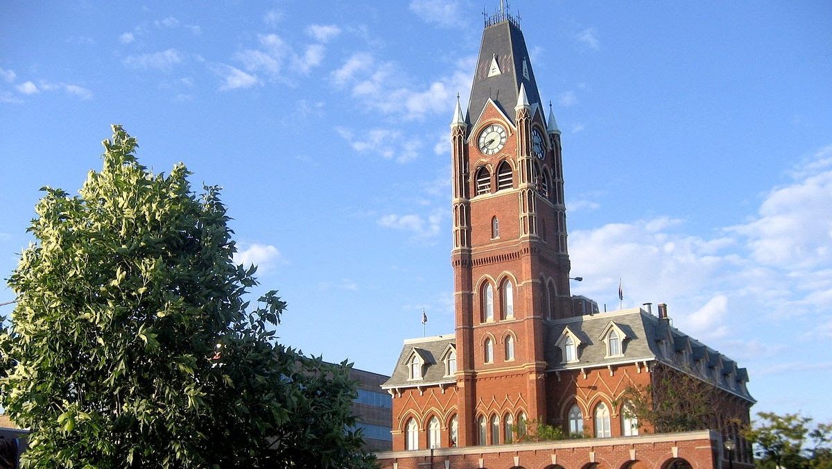
City centre
The Provincial Planning Policy Statement recognizes that maintaining and enhancing the vitality and viability of the downtown is important to the long
term economic prosperity of a community.
As one of the City’s Strategic Growth Areas, the City Centre is intended to be multi-functional; serving as the business, professional, cultural, entertainment and administrative centre of the City; and the policies of this Plan are intended to attract new investment to the core area
to enable it to prosper and grow as the business and administrative centre for the entire region. The City Centre is also targeted as a residential intensification area according to the Special Land Use Policies of Section 4.6.
The downtown core will prioritize high-density mixed-use development, active waterfront linkages, and human-centric urban design. The purpose of the City Centre designation on Schedule ‘B’ is to encourage the development of a variety of compatible land uses in the City’s core, overall creating a livable downtown that is compact, walkable, clean, secure, attractive, accessible and economically stable.
Development should increase the diversity and vitality of the downtown and create a lively and vibrant environment that supports a wide variety
of living, shopping, leisure, cultural and working activities that meet the daily needs of residents. The downtown will provide for a wide range of housing options, types, and tenures that meet the needs of residents in all stages of life. These housing options will consist of infill and intensification, redevelopment of underutilized properties, and adaptive reuse. Furthermore, the waterfront is a key asset that anchors the downtown core and is crucial to the City’s growth – development that takes advantage of the should respect and incorporate the
Moira River and Bay of Quinte.The City shall prepare Intensification Design Guidelines to assist in assessing compatibility of new development with surrounding area and uses.
Mixed use developments containing ground-floor commercial or community facility uses, with residential uses located above or behind the nonresidential uses, in a range of densities, building types, and forms.
3.8.2 before a) As a Strategic Growth Area, the City Centre will be the focus of intensification and will accommodate higher density mixed use development in a compact built form. Development in the City Centre will be planned to:
- Accommodate population and employment growth through a well-designed, compact built form that supports a pedestrian-oriented environment, active transportation, and a balanced multi-modal transportation system
- Accommodate infill and intensification through a range of densities, heights, and land-uses;
- Be a focus of residential, commercial, institutional, office, employment, recreational, cultural, social, and public open space uses;
- Be designed to have active uses on the ground floor with doors and windows connecting to thepublic sidewalk and public realm
more generally;- Be consistent with the existing street wall and setbacks;
- Be designed to utilize best practices for the design of midrise and tall buildings;
- Activate the waterfront through high-quality streetscape and architectural design, public art, and active uses at-grade;
- Support public transit and active transportation infrastructure; and,
- Conserve and have regard for cultural heritage resources.
3.8.2 after b) and before c) Mixed use development supports a more efficient use of land and a range of uses that contribute to greater walkability, increased housing choices, and greater social, cultural, and recreational opportunities. Mixed use development shall be encouraged in the form of medium and high-density developments throughout the City Centre, including buildings with ground-floor commercial, office, or community facility uses and live-work units.
This conforms with PPS (2024) 2.3.1.1 by identifying the City Centre as a strategic growth area. It further strengthens the role of the City Centre as the focus of growth and intensification through a compact and well-designed built form, facilitating mixed uses, active transportation, and high-quality design.
3.8.2 e d) The massing and height of buildings shall have regard for adjacent properties, cultural heritage resources, and the heritage value of the immediate areas. A balance between intensity and scale needs to be achieved, and may be subject to technical studies such as shadow studies, streetscape analysis, heritage impacts, and viewshed analyses, with considerations for additional setbacks, height restrictions, landscaping, building stepbacks, and more, in order to ensure an appropriate transition, mitigate impacts, and demonstrate compatibility with the
surrounding area.in many parts of the City Centre.
3.8.2 m) The City Centre should be transit-oriented and support a complete streets approach in the planning and design of new developments.
Development in the City Centre shall be facilitated through compact, dense, and walkable developments located close to public transit, along with transit-oriented design and facilities such as integrated active transportation infrastructure.
Bell Blvd and North Front St corridor
Bell Boulevard and North Front/Highway 62 are recognized as key intensification corridors within the City, intended to accommodate a mix and range of commercial and employment uses, and a range of housing options.
Development within the Bell Boulevard and North Front/Highway 62 Corridors shall make an efficient use of land, support active transportation, and be compact, walkable, and connected. High-quality urban and streetscape design is essential to ensure the appropriate development of commercial and residential uses and the overall success of an enhanced urban environment.
The Bell Boulevard corridor’s role as a major focus of employment and retail activity within the region would be enhanced through mixed use
development combining retail, commercial, and residential uses in accordance with the policies of this Section.
The Bell Boulevard Corridor is envisioned to evolve into a vibrant mixed use corridor with three (3) unique districts, as identified on Schedule ‘E’:
- Bell Boulevard West
- Bell Boulevard and Sidney Street Intensification
- Quinte Mall
Lands within the Bell Boulevard and Sidney Street Intensification District and Quinte Mall District that are designated Commercial Land Use are subject to the policies of this Section of the Plan. Development in the Bell Boulevard West District is subject to the policies of the West Belleville Secondary Plan or Section 3.12 of this Plan.
Quinte Mall District
The Quinte Mall District is envisioned to evolve into a vibrant, commercially focused node that builds upon and enhances its established role as a regional destination. Development in the Quinte Mall District shall be in accordance with the following:
- i. Development fronting Bell Boulevard should be in the form of mixed use buildings with commercial uses located on the ground floor with windows and entrances oriented to the street.
- ii. Stand-alone commercial development may be permitted. Stand-alone commercial uses shall be oriented to the street with parking provided in the rear or side yard. Where primary entrances are not oriented to the street, facades along frontages should interface and integrate into the streetscape and secondary entrances should be provided.
- ii. Residential only buildings may be permitted on larger lots as part of mixed use development of the entire lot. Residential only
- buildings fronting onto Bell Boulevard are discouraged and may only be permitted where it is demonstrated that the inclusion of commercial uses is not feasible.
- iii. Parking should be provided underground or in a structure. Where surface parking is necessary, it shall be provided in
- a side or rear yard and shall be screened from view.
- iv. Building heights in the Quinte Mall District shall not exceed 8 storeys.
- v. Development of new buildings under 3 storeys in height is discouraged and may only be permitted for stand-alone commercial development.
Bell Boulevard and Sidney Street Intensification District
The Bell Boulevard and Sidney Street Intensification District is envisioned to transform into a vibrant residential neighbourhood that builds upon its established employment and commercial character to create a unique destination with mid-rise residential and mixed use buildings fronting onto Bell Boulevard and Sidney Street.
Development in the Bell Boulevard and Sidney Street District shall be in accordance with the following:
- i. Standalone commercial uses should not front onto Bell Boulevard or Sidney Street.
- ii. Buildings at the intersection of Bell Boulevard and Sidney Street should wrap around the corner to create a continuous streetscape and be designed to reinforce their gateway location.
- iii. A range of housing types should be provided, including low-rise and mid-rise mixed use buildings, and predominantly higher density townhouses and apartments. Residential uses permitted include street, block, stacked or back-to-back townhouses, multiplexes and apartment buildings.
- iv. Residential only buildings fronting onto Bell Boulevard or Sidney Street are discouraged and may only be permitted where it is demonstrated that the inclusion of commercial uses is not feasible.
- vi. Building heights in the Bell Boulevard and Sidney Street Intensification District shall not exceed 9 storeys in height.
- vii. Development of new buildings under 3 storeys is discouraged along the frontages of Bell Boulevard and Sidney Street.
- viii. Compatibility between adjacent Employment uses and residential and other sensitive uses shall be achieved inaccordance with applicable provincial guidelines and standards as well as the policies of this Plan.
- ix. Existing Employment uses within the Bell Boulevard and Sidney Street Intensification District shall be permitted uses and the policies of this Plan shall not apply to prevent their continuation or future expansion and improvement.
North Front Street District
a) The North Front Street District is identified on Schedule ‘E’ and envisioned to transform into a vibrant destination with an active, pedestrian-focused streetscape characterized by a mix of compact low-rise and mid-rise buildings that provide a range ofcommercial and residential uses.
b) Development within the North Front Street District shall be in accordance with the following:
i. Development fronting North Front Street should be in the form fo low-rise and mid-rise buildings with commercial uses located on the ground floor with windows and entrances oriented to the street.
ii. Stand-alone commercial development may be permitted. Stand-alone commercial uses shall be oriented to the street with parking provided in the rear or side yard. Where primary entrances are not oriented to the street, facades along frontages should interface and integrate into the streetscape and secondary entrances should be provided.
iii. Stand-alone residential buildings may be permitted and should be located at the rear of properties as part of a larger comprehensive development. Stand-alone residential buildings may be in the form of street or block townhouses, stacked townhouses, back-to-back
townhouses, multiplexes, or apartment buildings.iv. Building setbacks along North Front Street should be consistent in depth but may vary to accommodate landscaping, plazas, patios, or other public spaces.
v. Building heights in the North Front District shall not exceed 9 storeys in height.
vi. Development of mid-rise buildings over 4 storeys in height shall be limited to sites without adjacent low density residential uses, except where it is demonstrated that an appropriate transition will be provided.
vii. Development of new buildings under 3 storeys is discouraged along the North Front Street frontage and may only be permitted for stand-alone commercial development.
Where appropriate, greyfield sites in strategic growth areas may be considered for redevelopment for mixed use development.
The PPS (2024) recognizes that underutilized greyfield sites provide opportunities for redevelopment in strategic growth areas. This policy recognizes these sites may provide opportunities for housing or mixed uses to accommodate targeted growth.
Hamlets shall facilitate limited growth. When directing development in hamlets, consideration shall be given to locally appropriate rural characteristics, the scale of development, and the provision of appropriate service levels to support the development.
Consistent with PPS (2024) 2.5.2 regarding growth in rural settlement areas.
Employment land
3.12 Areas designated Employment Land Use on the land use schedules are intended to serve as the major concentrations of industrial activity and employment in the City. The Municipality is committed to planning for, protecting and preserving employment lands for current and future uses, and to ensure that the necessary infrastructure is provided to support current and projected needs.
Industrial areas are considered to be the City’s major enterprise zones, and the policies of this Plan are intended to provide flexibility to enable firms to respond quickly to changing economic conditions. General industrial uses may be large or small scale and may or may not be in
enclosed buildings, and are usually incompatible with non-industrial uses. Service industrial uses are generally located within enclosed buildings with limited outdoor storage and do not produce levels of noise, dust or odours characteristic of general industrial uses which can be detected off-site.
Uses permitted in areas designated Employment Land Use include activities associated with the manufacturing, research and development, assembling, fabricating, packaging or processing of goods and services, including transportation/truck terminals, warehouses, railway uses,
and other similar uses and ancillary facilities. Other compatible uses include retail and office uses accessory to industrial uses.
Agricultural
While pushing for urban density, the report strengthens protections for Belleville’s rural assets.
- Agricultural System Approach: The city will adopt a system-wide approach to protect the agri-food network.
- Impact Assessments: Any application for non-agricultural uses in prime areas will now require a professional Agricultural Impact Assessment (AIA) to mitigate damage to the agricultural land base.
- Lot Creation: Residential lot creation in agricultural areas remains highly restricted, though accessory dwelling units (up to two per lot) are permitted to support farm worker housing and rural residents.
The City shall use an agricultural system approach based on provincial guidance, to maintain and enhance a geographically continuous agricultural land base and support and foster the long-term economic prosperity and productive capacity of the agri-food network.
Consistent with PPS (2024) 4.3.1.1 for the long-term functioning of the agricultural land-base.
3.2.2 c) A principal dwelling associated with an agricultural operation shall be permitted in prime agricultural areas as a main agricultural use, in accordance with provincial guidance, except where prohibited in accordance with 3.2.2 r).
3.2.2 d) Where a residential dwelling is permitted on a lot in a prime agricultural area, up to two accessory dwelling units shall be permitted in accordance with provincial guidance, provided that, where two accessory dwelling units are proposed, at least one of these accessory dwelling units is located within or attached to the principal dwelling, and any accessory dwelling units:
- i. comply with the minimum distance separation formulae;
- ii. are compatible with, and would not hinder, surrounding agricultural operations;
- iii. have appropriate sewage and water services;
- iv. address any public health and safety concerns;
- v. are of limited scale and are located within, attached, or in close proximity to the principal dwelling or farm building cluster;
- vi. minimize land taken out of agricultural production.
Lots with accessory dwelling units may only be severed in accordance with policy 3.2.2 r).
3.2.2 e) The two accessory dwelling units that are permitted on a lot in a prime agricultural area in accordance with 3.2.2 d) are in addition to farm
worker housing permitted as an agricultural use.
3.2.2 f) Lot creation in the Agricultural designation is discouraged and will only be permitted in accordance with Provincial Policy, and will be subject to the following policies:
- One new residential lot per farm consolidation for a residence surplus to an agricultural operation per the requirements of 3.2.2 r).
3.2.2 s) The City may permit nonagricultural uses such as extraction of minerals, petroleum resources and mineral aggregate resources or limited
non-residential uses In considering any application to amend this Plan to permit a non-agricultural use on prime agricultural lands. Non-residential uses will only be permitted where the proposed development or land use necessitating the amendment:
This policy is consistent with PPS (2024) 4.3.5.1 regarding nonresidential uses that are permitted in prime agricultural areas.
3.2.2 t) Impacts from any new or expanding non-agricultural uses on the agricultural system are to be avoided, or where avoidance is not possible, minimized and mitigated as determined through an agricultural impact assessment or equivalent analysis, based on provincial guidance.
Consistent with PPS (2024) 4.3.5.2 regarding the requirement for an Agricultural Impact Assessment in order to minimize and mitigate
impacts on the agricultural system.
Open space
3.6.2 a) Parks and open space in the City shall be designed to be safe, meet the needs of persons of all ages and abilities, including pedestrians, foster social interaction, and facilitate active transportation and community connectivity.
Consistent Consistent with PPS (2024) 3.9.1 regarding the planning and design of healthy and inclusive communities.
3.6.2 e) Points of ingress and egress for open space areas should be established to ensure safe and accessible movement of vehicular, pedestrian, and cyclist traffic from the public street and the subject and adjoining lands.
This amendment aligns with the approved OPA No. 10 that aligns with the 2021 Parkland and Recreation Master Plan.
All open space areas should have safe and accessible pedestrian access and circulation on-site.
This amendment aligns with the approved OPA No. 10 that aligns with the 2021 Parkland and Recreation Master Plan.
Mineral aggregate
Mineral aggregate resources and petroleum resources shall be protected for long-term use. Where provincial information is available, deposits of mineral aggregate resources shall be identified.
Consistent with PPS (2024) 4.4.1.1 and 4.5.1.1 regarding the long-term protection of mineral and petroleum resources.
3.7.2 e) All pits and quarries should be operated in such a manner which minimizes social, economic, and environmental impacts and so as to
satisfiesy the requirements of the Ministry of the Environment, Conservation and Parks with respect to pumping and dewatering, water supply,
waste water, solid and liquid waste disposal, dust and all emissions to the atmosphere including noise and vibrations.


Comments
We want to hear from you! Share your opinions below and remember to keep it respectful. Please read our Community Guidelines before participating.